Arctic Ocean Sea Ice Extent varies with the season, being highest around mid March and lowest around mid September. The amount of ice at the poles varies with the insolation, but the system exhibits some thermal inertia, that is, the actual ice coverage lags behind the solar insolation; it takes time for all that water to heat up and cool off.
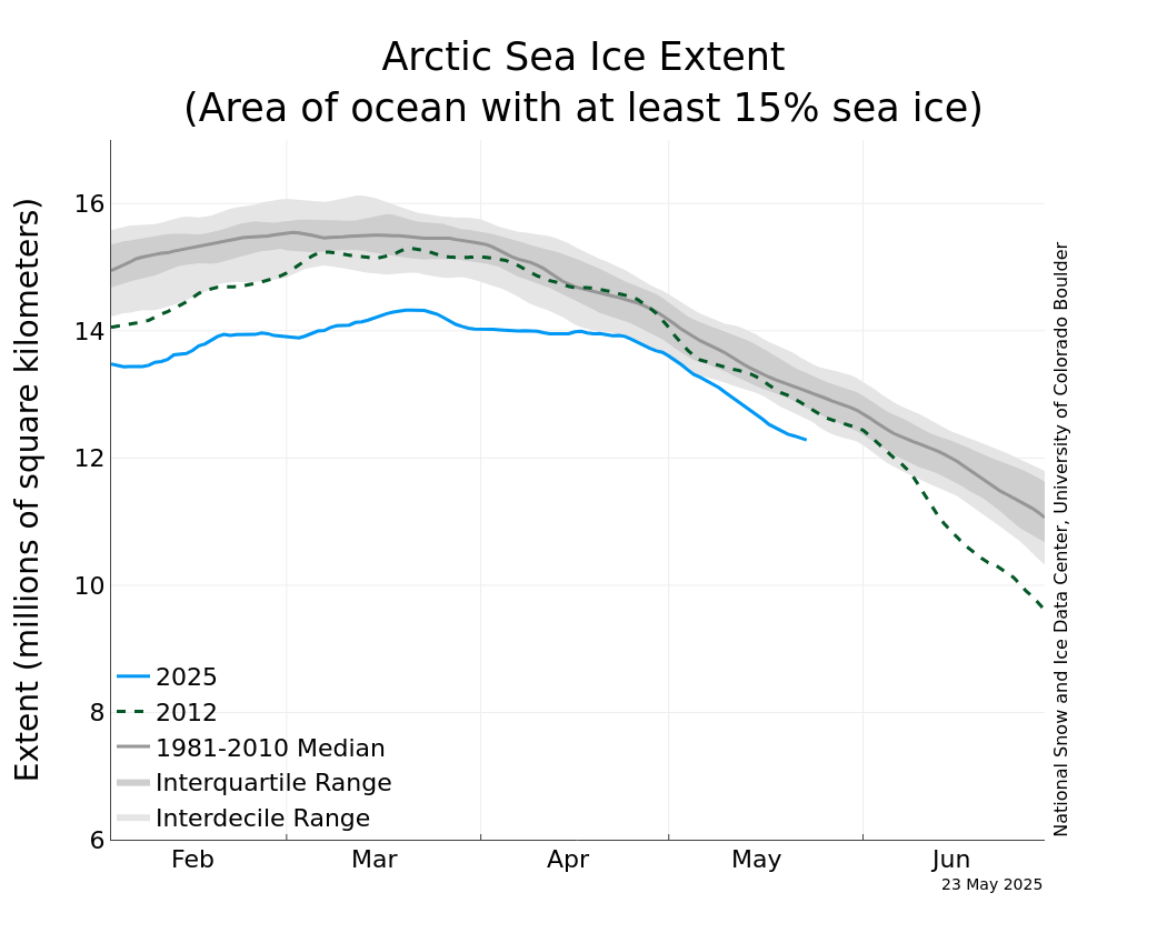
Right now, we are rapidly approaching SIE maximum, in a few days the ice coverage will max out and then begin to gradually diminish. What is unusual about the sea ice today is that there is less ice floating on the Arctic Basin than at any other time than in the satellite era on this date. IOW, 2025 is shaping up to be the lowest SIE maximum since 1979! Check it out using the NSIDC Charctic Interactive Sea Ice Graph here:
https://nsidc.org/sea-ice-today/sea-ice-tools/charctic-interactive-sea-ice-graph
Use the graphic tools provided to compare past years to this one. Yes, there is a lot of year-to-year variation, but the general trend is clearly ‘down’. The pole is melting away before our eyes. There’s even a good chance that the fall MINIMUM this year will be the lowest in the satellite era, beating the low ice minimum set in September, 2012 (the red dashed line on the graph). Toggle those colored year buttons to get an idea of how Sea Ice Extent is dropping over the last half-century or so.
You can also use this graphic to explore the effects on global warming on the Southern Hemisphere, where the general pattern is the same, but not as dramatic, as it is in the North. The South is mostly ocean, and the continental icecap in Antarctica helps to stabilize the climate there, so the effects of climate change are not as extreme as in the Northern Hemisphere. Unfortunately, most of the land, people (and farmland) are in the North.
Keep an eye on this NSIDC website. Its only a matter of time before our budget-conscious Washington cost-cutters pull the funding plug on it.