Arctic sea ice was at a satellite-record low for the second month in a row. The first three weeks of February saw little ice growth, but extent rose during the last week of the month. Arctic sea ice typically reaches its maximum extent for the year in mid to late March.
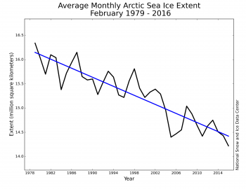
This is a comparison of the Feb ice extents during the era of satellite measurements.
http://nsidc.org/arcticseaicenews/files/2016/03/Figure3_0301-350×270.png

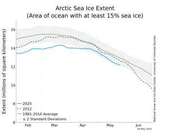
In the graphic below
The blue line is what the ice has been doing for the last 4 months. The dashed line is the record low ice year of 2012. The black line is the mean over the time satellite measurements have been made (since 1979). The gray band is +/- two standard deviations.

http://nsidc.org/data/seaice_index/images/daily_images/N_stddev_timeseries_thumb.png
February 2016 sea ice extent was the lowest in the satellite record at 14.22 million square kilometers (5.48 million square miles). The linear rate of decline for February is now 3.0 percent per decade.
The linear rate of summer decline (September) is over 13% per decade.